Plant-population recovery across large disturbance areas is often seed-limited. An understanding of seed dispersal patterns is fundamental for determining natural-regeneration potential. However, forecasting seed dispersal rates across heterogeneous landscapes remains a challenge. Our objectives were to determine (i) the landscape patterning of post-disturbance seed dispersal, and underlying sources of variation and the scale at which they operate, and (ii) how the natural seed dispersal patterns relate to a seed augmentation strategy. Vertical seed trapping experiments were replicated across 2 years and five burned and/or managed landscapes in sagebrush steppe. Multi-scale sampling and hierarchical Bayesian models were used to determine the scale of spatial variation in seed dispersal. We then integrated an empirical and mechanistic dispersal kernel for wind-dispersed species to project rates of seed dispersal and compared natural seed arrival to typical post-fire aerial seeding rates. Seeds were captured across the range of tested dispersal distances, up to a maximum distance of 26 m from seed-source plants, although dispersal to the furthest traps was variable. Seed dispersal was better explained by transect heterogeneity than by patch or site heterogeneity (transects were nested within patch within site). The number of seeds captured varied from a modelled mean of ~13 m−2 adjacent to patches of seed-producing plants, to nearly none at 10 m from patches, standardized over a 49-day period. Maximum seed dispersal distances on average were estimated to be 16 m according to a novel modelling approach using a ‘latent’ variable for dispersal distance based on seed trapping heights. Surprisingly, statistical representation of wind did not improve model fit and seed rain was not related to the large variation in total available seed of adjacent patches. The models predicted severe seed limitations were likely on typical burned areas, especially compared to the mean 95–250 seeds per m2 that previous literature suggested were required to generate sagebrush recovery. More broadly, our Bayesian data fusion approach could be applied to other cases that require quantitative estimates of long-distance seed dispersal across heterogeneous landscapes.
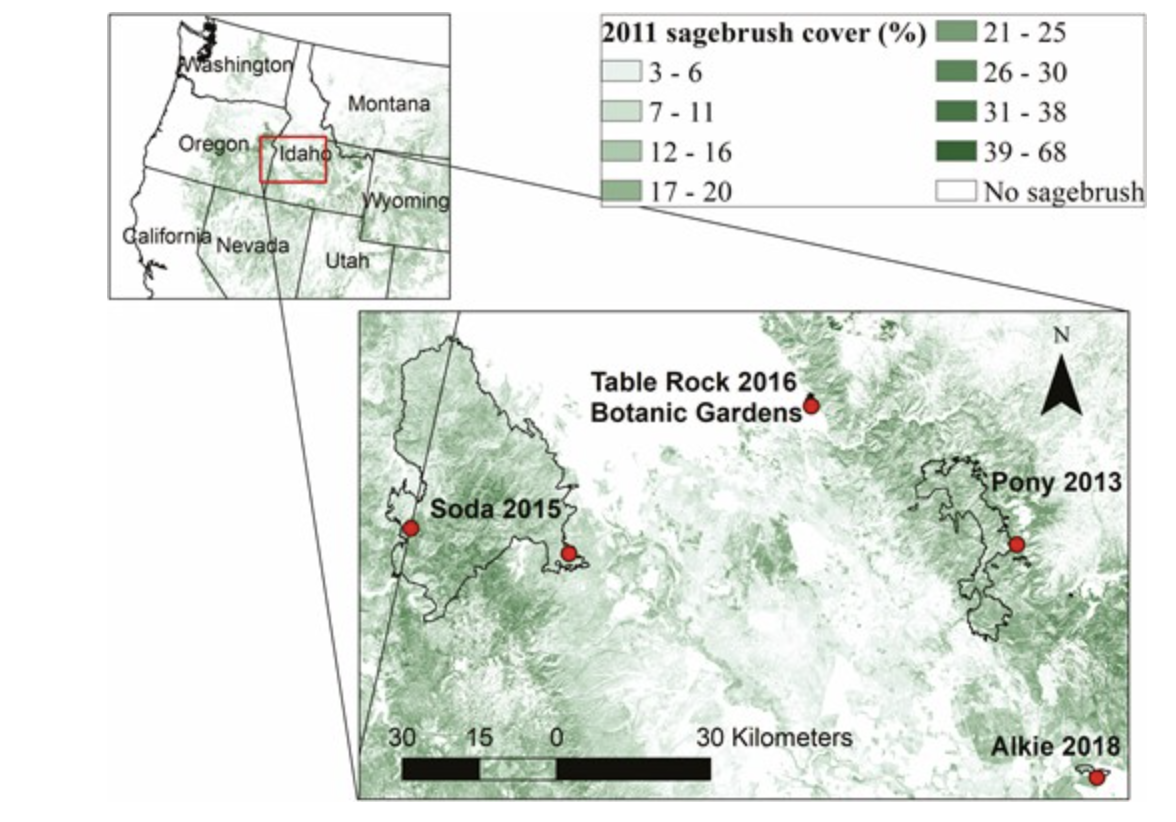
Locations of fires (outlines) and trapping sites (dots) for dispersal study shown as an inset map on western USA and 2011 sagebrush cover (%) from the National Land Cover Database (NLCD) (Rigge et al. 2020).
| GEM3 author(s) | |
| Year published |
2022
|
| Journal |
AoB PLANTS
|
| DOI/URL | |
| Keywords |
Ecology
Landscapes
Sagebrush
|
| GEM3 component |
Mechanisms
|
| Mentions grant |
Yes
|