Predicting the edges of species distributions is fundamental for species conservation, ecosystem services, and management decisions. In North America, the location of the upstream limit of fish in forested streams receives special attention, because fish-bearing portions of streams have more protections during forest management activities than fishless portions. We present a novel model development and evaluation framework, wherein we compare 26 models to predict upper distribution limits of trout in streams. The models used machine learning, logistic regression, and a sophisticated nested spatial cross-validation routine to evaluate predictive performance while accounting for spatial autocorrelation. The model resulting in the best predictive performance, termed UPstream Regional LiDAR Model for Extent of Trout (UPRLIMET), is a two-stage model that uses a logistic regression algorithm calibrated to observations of Coastal Cutthroat Trout (Oncorhynchus clarkii clarkii) occurrence and variables representing hydro-topographic characteristics of the landscape. We predict trout presence along reaches throughout a stream network, and include a stopping rule to identify a discrete upper limit point above which all stream reaches are classified as fishless. Although there is no simple explanation for the upper distribution limit identified in UPRLIMET, four factors, including upstream channel length above the point of uppermost fish, drainage area, slope, and elevation, had highest importance. Across our study region of western Oregon, we found that more of the fish-bearing network is on private lands than on state, US Bureau of Land Mangement (BLM), or USDA Forest Service (USFS) lands, highlighting the importance of using spatially consistent maps across a region and working across land ownerships. Our research underscores the value of using occurrence data to develop simple, but powerful, prediction tools to capture complex ecological processes that contribute to distribution limits of species.
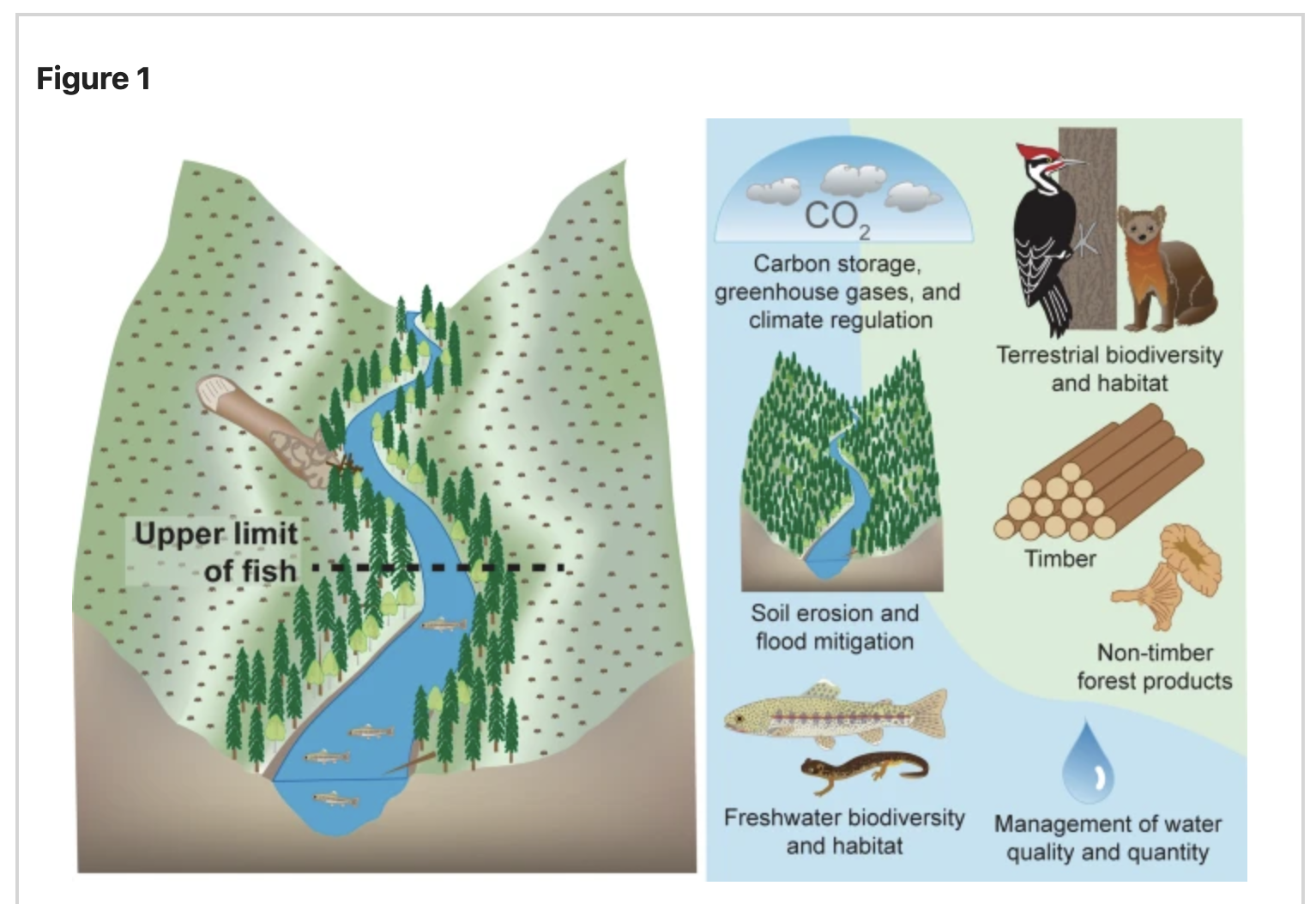
Ecosystem services at the upper limit of fish. Forest-freshwater ecosystems jointly produce benefits from nature, also known as ecosystem services, such as carbon storage, greenhouse gases, and climate regulation, aquatic and terrestrial biodiversity and habitat, mitigation of soil erosion and floods, timber and non-timber products, and management of water quality and quantity. Ecosystem services are jointly produced, thus when forests are harvested, the trajectory of ecosystem services associated with forest-freshwater ecosystems may change. Riparian buffer regulations for forest harvests depend on the upper limit of fish. Forest management practices near the upper extent of fish affect the levels of co-produced ecosystem services associated with the riparian buffer. [Figure developed in collaboration with coauthors by Kathryn Ronnenberg (USDA Forest Service, PNW Research Station)].
| GEM3 author(s) | |
| Year published |
2022
|
| Journal |
scientific reports
|
| DOI/URL | |
| Keywords |
Ecology
Physiology
Landscapes
|
| GEM3 component |
Mapping
Mechanisms
|
| Mentions grant |
Yes
|